Monday, July 9, 2007
What we did Friday.
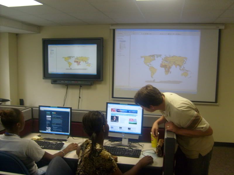
Friday we worked on GIS (which stands for geographic information system). It was fun and we enjoyed making maps on there. I couldn't do anything because every computer I got on kept malfunctioning.But I had fun watching everybody else work on the maps. We even had a competition to see who could make the exact duplicate of Charlie's map(marquez won). After that we went to lunch and Marquez and I went and played basketball. After lunch we gathered around a table and discussed our project ideas. We had some very good ideas which brought up some very interesting topic disputes.

Introduction to GIS
Last week we were introduced to something called GIS. ( Geographic information systems).This system helped us look at the neighborhood as well as different countries in many different ways. GIS informs you on the statistics of certain places in the world, for example we was able to look at the amount of phone lines as well as cell phones per person. We was also able to look at research that showed us showed us the major things like where earthquakes and volcano's have been discovered to the small things like the percentage of agriculture in and around that specific area.
As we begained to comprehend how to use GIS we was able to create our own versions. My map showed the amount of earthquakes recorded at the time compared to the amount recorded in 2003 and 2004. I also took information about the area. What kind of land it was the average temperature and connected it to the earthquakes to see if it had something to do with the ones that were active and the was that were solfatara(blowing out gases that were possibly poisonous). I discovered that most of the earthquakes were cluttered in the areas where plates would meet especially in and around Japan within the pacific and Chinese-Indonesia plates.
As we begained to comprehend how to use GIS we was able to create our own versions. My map showed the amount of earthquakes recorded at the time compared to the amount recorded in 2003 and 2004. I also took information about the area. What kind of land it was the average temperature and connected it to the earthquakes to see if it had something to do with the ones that were active and the was that were solfatara(blowing out gases that were possibly poisonous). I discovered that most of the earthquakes were cluttered in the areas where plates would meet especially in and around Japan within the pacific and Chinese-Indonesia plates.
What's GIS
What is GIS? First of all, the letters GIS stand for Geographic Information Systems. GIS is a rapidly growing technological field that incorporates graphical features with tabular data in order to assess real-world problems. What is now the GIS field began around 1960, with the discovery that maps could be programmed using simple code and then stored in a computer allowing for future modification when necessary. The earliest version of a GIS was known as computer cartography and involved simple linework to represent land features. From that evolved the concept of overlaying different mapped features on top of each other to determine patterns and causes of spatial phenomenon.
REFERENCE
What I Think About GIS?
I think GIS is a group program that let you map areas and places that are in a specific area. GIS stands for Geographic Information System and you also make maps on there. When you make a map you can be more specific about what you want to show on the map. It also have different symbols for everything and you can pick what symbols you want.
When I first got on GIS, I thought it was boring, but when I got the hang of the whole system it was alright. I foundout that you can add fault lines, volcanoes, and earthquakes. You can add airports, too. GIS help you understand your surroundings better and give you more information about your community.
When I first got on GIS, I thought it was boring, but when I got the hang of the whole system it was alright. I foundout that you can add fault lines, volcanoes, and earthquakes. You can add airports, too. GIS help you understand your surroundings better and give you more information about your community.
Sunday, July 8, 2007
My Feelings On Problem Properties
Anyone who knows me will tell you: I've got BIG dreams! I have things planned that noone else would ever think of. I HAVE to go to MTSU, get married by age 26, and three years later begin starting a family and eventually have three to four children and a red Dodge Caravan with cloth interior parked in our three car garage at our five bedroom, 3.5 bath home in Murfreesboro, TN. This sounds SUPER crazy to some, but its my plan. A pretty good one, I think. I chose Murfreesboro because of its suburban setting (population of 75, 468), and its low crime rate (778 violent crimes per 100K people in 2006, compared to Memphis' 1, 860 per 100K people). Also, I took into consideration the property values. I checked on the number of vacant homes in different areas of the city and I was content. Problem properties are a HUGE problem in my neighborhood, and in this city. Whether its a vacant home, a "traphouse", or one with residents that isn't up to code: They're a problem! Believe it or not, problem properties coincide with my dreams. I'm planning on having a family and if I'm going to raise children, I can't live near a problem property. Problem properties would open my children's eyes to a world of crime, trouble, and other negative ideas and actions that I wouldn't want them seeing. Also, problem properties wouldn't allow my children the chance to be children. They'd be forced to stay inside and in sight all of the time. Whether it be an abandoned house used as shelter for the homeless, a boarded up home used as a dumping site for residents, a brothel, or a "traphouse", I wouldn't raise my children next to it. I wouldn't even raise them in the same community! My dreams are very specific and problem properties DON'T fit into them!
A traphouse is a house used for the distributions of illegal substances.
A traphouse is a house used for the distributions of illegal substances.
Tuesday, July 3, 2007
Problem Properties
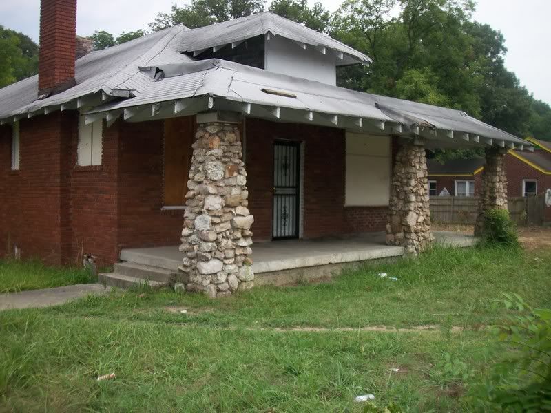
Today, we talked about problem properties in our neighborhoods. Problem properties are just that: Properties that cause a problem in their neighborhoods. These properties could be vacant & boarded up or they could be inhabited but in violation of city code. Problem properties are the first symptom of neighborhood decline; they bring down the property value of the homes in their otherwise healthy neighborhoods; and they might indicate that a land-use is not the best use for that neighborhood. For instance, a corner-lot home that cannot seem to keep residents because of the busy street might be better-used for a corner-store.
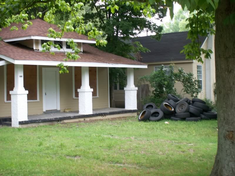
Earlier today, we split up into two groups and set off to photograph problem properties within the blocks of Semmes & Highland and Southern & Park. We gathered data in the Messick-Buntyn area about problem properties. We saw plenty of houses that made the neighborhood look bad. The pictures below are indicative of some of the properties that we consider problem properties. As we continue to work on our project, we will be mapping and addressing how the neighborhood can resolve these problem properties.

798 Brower


3262 Park Ave.

846 S. Greer
Earlier today, we split up into two groups and set off to photograph problem properties within the blocks of Semmes & Highland and Southern & Park. We gathered data in the Messick-Buntyn area about problem properties. We saw plenty of houses that made the neighborhood look bad. The pictures below are indicative of some of the properties that we consider problem properties. As we continue to work on our project, we will be mapping and addressing how the neighborhood can resolve these problem properties.
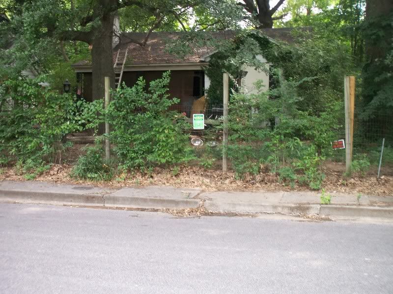
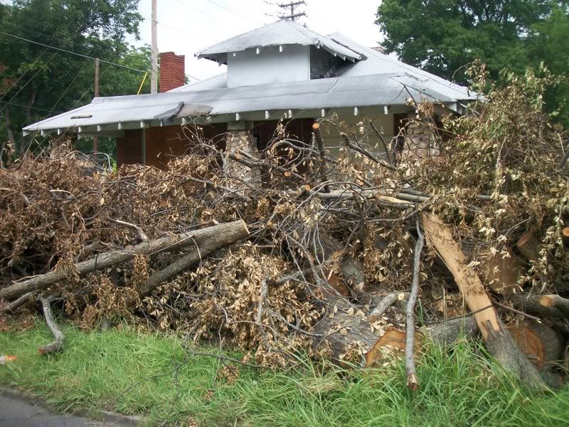
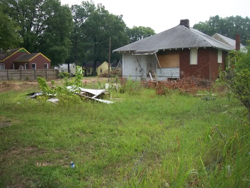
3262 Park Ave.
Monday, July 2, 2007
I Feel Like Such A... City Planner!!! lol
- Today was a veryyy interesting day. First, Patience, Selena, and I went to St. Luke's United Methodist Church on Highland to assist with "appreciation cookies" for the mostly hispanic construction workers who are building the new apartment complex on Highland, across the street from the church. It was an unforgettable experience! I had so much fun attempting to converse and watching Patience translate. Oh and the cookies were GREAT!!
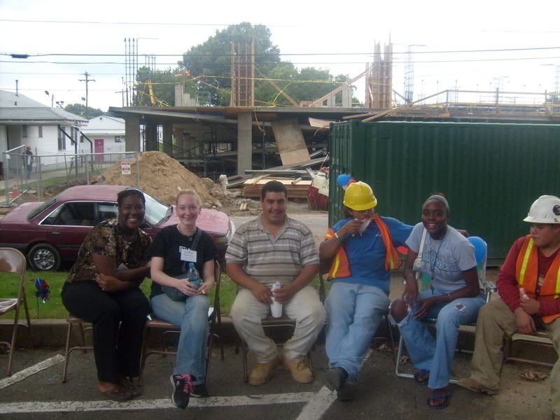
- While we were enjoying our "galletas", Mr. Andrew, Marshanique, Shay, Patrick, Jeremy & Marquez were going to Davis Park to do some behavior mapping. However, when they got to Davis, there was no behavior to map.
- Then we all met up for lunch at Wendy's.
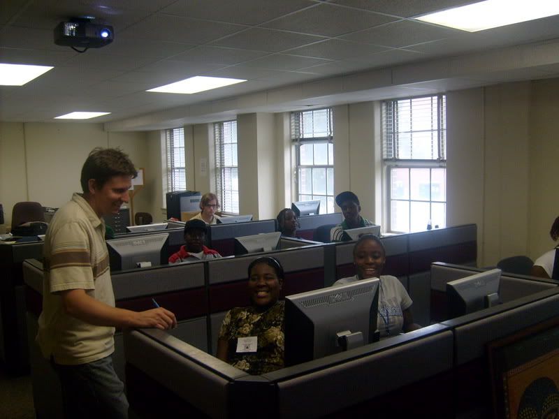
- After lunch, we drove to the University's City Planning Lab and learned how to use ArcGis Mapping Software. It was surprisingly FUN! lol We learned new and interesting facts about different countries and differences and similarities between them.
- This program will DEFINITELY be of good use with making our neighborhood better. Not only will we be able to map crime; but we'll be able to map the locations of abandoned houses, streetlights, trees, parks, corner stores, etc., and see if the presence or lack of those have any affect on the neighborhood
Subscribe to:
Posts (Atom)