Tuesday, July 31, 2007

BACK 2 DA BASICS


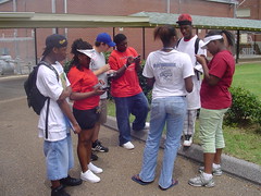
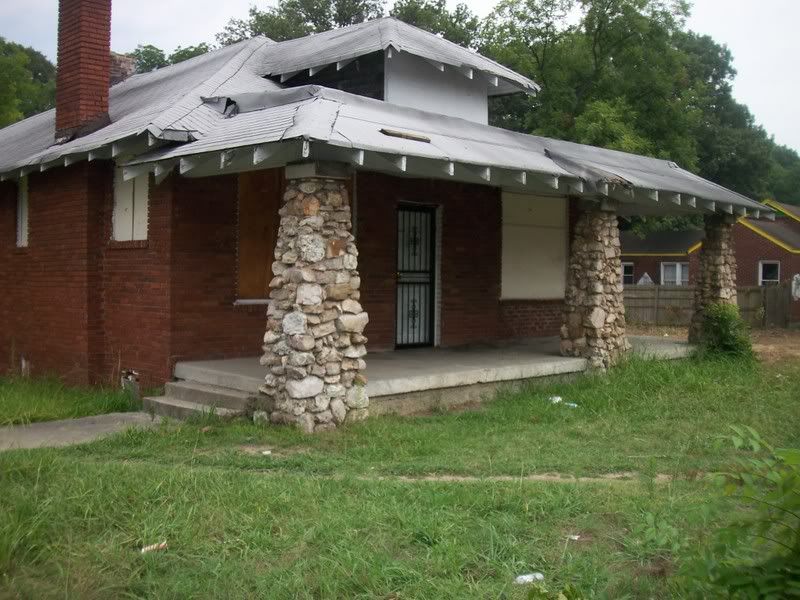
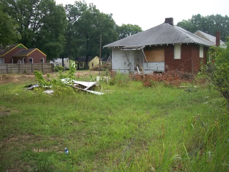
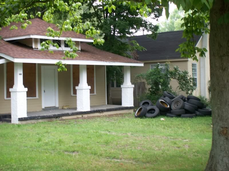
What's up world!!! This is Shay logging in for the last time at the work house. I am originally from South Memphis, Tennessee. I now live in the East Memphis area, but this summer I worked in a neighborhood that I was unfamiliar with. Majority of my fellow employees were from the Messick-Buntyn neighborhood which made me feel uncomfortable because I had no prior knowledge of this community that I was placed to work in. However, I am happy to say that this experience has changed my perspective of how I interpret what others say because this summer I have learned more about a neighborhood that those around me target as problematic.

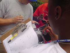
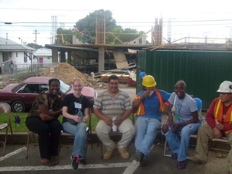
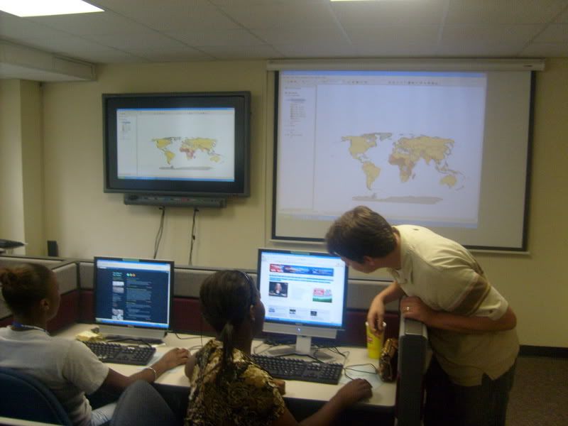
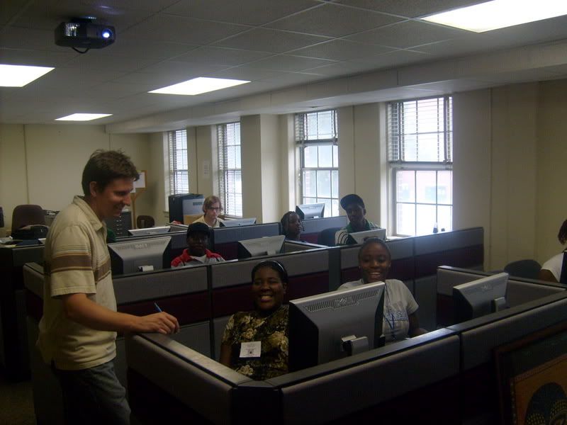
Will I use the skills that I have learned later in life? Of course. I mean I enjoyed the cool technology that we used throughout the summer, and when I attend college if I need to incorporate some of the skills that I learned this summer then I will. Also, I received insight on power points which I enjoy doing, and I am aware that my senior year will be filled with power points (thanks Mr. Andrew, Patience, and Mr. Charlie for the tips). Mapping just might be in my future.

PLANNING for the future...

This summer has been a big one. One for learning new things. One for making a difference. One for change. I've enjoyed my summer work with this program and I will be taking back so many of the skills I've gained and improved. I came into this program not knowing for sure whether or not I'd enjoy city planning, and I now see the changes in myself and in my opinion towards communities.
I've always known about deadlines and waking up on time, but this job forced me to do it. If I said I was going to type something I had to, and I had to make sure it was of good quality because this was important. I've learned to be dependable and to be responsible for my actions and my assignments. I'll always remember the people i worked with and that it only takes a few people to make a difference. I can't wait to begin this school year with a new outlook on my community, this city, and my life. I feel so blessed to have had this experience.

-Skyler

In Retrospect......

This summer was like something I've never experienced before. I learned so much in so little times. Not to mention, the great team I worked with. My favorite person out of the whole group would have to be Skyler. She was such a unpredictable person. She was very cool to work with, and she has such a beautiful voice and she always so joyous and such a spirit lifter. I'm not going to say my least favorite person because that would be kind of mean. LOL! And our supervisors Mr. Andrew Trippel, Mr. Charlie Santo, and Mrs. Patience Jarrett-Beck were MARVELOUS! They were so fun to be with everyday!! They taught us so much. The information I've learned this summer is something that I will value and cherish forever. But ovreall this summer has been great.We used the ArcPad software with the GPS hand held. ArcPad is software for mobile GIS and field mapping applications using handheld and mobile devices.These things were the size of a calculator!! We learned things in a week that some college students don’t learn in a 3-6 months. It was such a learning experience to work in this field this summer. We learned some new terminology that city planners use on a daily basis. I think I speak on behalf of all my co-workers when I say that this was a learning and fun-filled summer.

Will i use the skills that i learned in the future.

Will I use the skills that I learned in the future, yes I think I will. I didn't know that what we were doing took college students a semester to learn and we learned it in a few weeks. I might even want to go to college and pursue a degree in city planning. This was a fun experience, it had its boring times but overall it was fun (especially when I got paid). I hope every one else feels like this about the conclusion of the Y.N.M.I program.

I learned about different agencies and groups. One particular group that I thought was really good was P.A.C.A (police and citizens alliance), they were basically retired men who painted over graffiti where ever they seen it. I also didn't know that code enforcement had that much authority. I found out that it is illegal to evict people and put their furniture outside. Well this was my last blog goodbye.

Friday, July 20, 2007

What We Did This Week?

Monday- We put all the problem properties, that we surveyed Friday, on ArcMap.

Tuesday- We interviewed people at Davis Community Center to see what they think about Davis Park and their neighborhood.

Wednesday- We got together and put our presentation together for our Neighborhood Meeting on July 31st.

Thursday- We had to be at the Blue Crush weekly meeting at 9:00 at Airways Substation and we learned about all the targeted crimes that are going on the city of Memphis. The t.v. and movies doesn't lie about police loving donuts and coffee. Then, we split up into two groups, one group went to Brentwood Park and the other group went to Peabody Park to take park surveys. Then we had a presentation for the Humes' Students and Memphis Heritage came gave a presentation.

Friday- Today we going to take surveys of Marquette Park and Aurbon Park and we going to create maps of Brentwood Park, Marquette Park, and Aurbon Park.


This week I learned not to judge a community by what the televisions say because what they say about Orange Mound isn't true and when we surveyed the people in the community they are saying they don't see as many problems in their community as what I thought there would be. There isn't that much in the community going by what all the neighbors in the neighborhood saying. So, stopping judging different communities by what you heard and judge by what you know about the communities. By gathering data, we learned to know the community more and learned not to judge the community.

Tiresome Thursday!!

WOW!! Was Thursday a day or what???!! Now, normally we go in for work at 11 am. HOWEVER, on Thursday we got went in at 8:00!! We had such a BUSY day!! Our first visit was to the Blue C.R.U.S.H. weekly meeting. There we learned about the latest crimes in our area. They biggest thing was the copper thefts. It is AMAZING how expensive it is to repair damages when idiots steal copper. It was stunning to hear of how many teenagers that are committing crimes. Can you believe that teenagers outnumbered adults? OMG!! And I REFUSE to not inform you of the food they had at the meeting. MAN!! I LOVE food!! They had all kinds of donuts, salads, chicken bites,orange juice, grape juice, water, and coffee. That wasn't the best part of the day though. When we left there, we went to the University of Memphis for a meeting with Memphis Heritage's June West. She was very enthused about telling us about the history of Memphis. She showed us a lot of historic buildings that were torn down and rebuilt, some that were flat out demolished, and some that are yet and still standing. Now that I know how some buildings downtown used to look, I'll look at them differently. It seems like the traditional buildings looked better that the more modern architecture. It doesn't seem like a lot, but BOY was it a tiring DAY!!!

WHEN DID THEY STOP CARING!!!!!!

Let's do a quick review. On Friday 13, 2007 the Youth Neighborhood Mapping Initiative team went out on a scavenger hunt for problem properties in the Messick-Buntyn community. In my last blog, I mentioned how we used the GPS handheld to distribute Arc Map for the purpose of gathering data on these problem properties. Also, I stated how there weren't as many problem properties as I thought there would be, but to my surprise that was untrue. I could only speak for the area that I scouted, but when we all brought our information together I was disappointed.

So I propose the question, "when did they stop caring?" The "they" that I am referring to in the previous sentence are the residents of the Messick-Buntyn area. 79 out of the 907 properties of the Messick-Buntyn area were problem properties in our perspective. With that 79 out of 907, that means that .08% of the area is a liability to the enhancement of the community. A liability is nothing more than a hindrance to a healthy, livable community, yet with the looks of these numbers a healthy, livable community isn't a necessity anymore to the residents.

Let me tell you all something. When you want something done you have to do it yourself. You can't depend on this person, that person, this group of people, or that group of people. Look where it has gotten you "nowhere". All you need is a plan to turn a liability into an asset, and that isn't hard. Clean up day here and clean up day there, that is a start. We as youth can't tackle this problem alone. We can only bring to the light what you all are blinded by. So, if you want to live in an area of liabilities then you aren't the community I thought you were. You must come together to uplift your community because if you don't I pose another question, "WHO WILL?!"

WHEN DID THEY STOP CARING IS THE PROBLEM!
WHEN WILL THEY START CARING IS THE ANSWER!!!!

THE NEW PERSPECTIVE

This week we went out into the community and surveyed people on what they thought about our neighborhood park, Davis Park. A lot of the interviews resulted in the same answer and concerns. Three out of the four people we surveyed believed that the park needed better equipment, someone to clean up the litter, and someone to cut the grass and maintain the park in general. When it came to the neighborhood, again three out of the four thought that the neighborhood was at its worst now because of younger people moving into the neighborhood and becoming bad influences. One person thought that the neighborhood was at its Best now and that the park was perfect besides the grass needing to be cut.

Another thing that we did this week was go to a BLUE C.R.U.S.H meeting. The Blue Crush (Criminal Reduction Utilizing Statistical History) is a Memphis Police Department driven initiative which utilizes new technology to create multi-layer, interactive maps of crime hot-spots based on data from the previous week's arrests and incidents. The meeting showed us the main things that these certain police officers were tackling, ranging from copper thefts to burglaries of stores and houses. It personally amazed me that copper thefts alone have the city of Memphis in a 1,000,000 dollar debt. We left that meeting with a new perspective on our neighborhood.

Later on in the day we went to Peabody Park surveyed how beautiful it was how much it offered and maybe what could be added, but it passed with flying colors. The other park we surveyed for the day was Brentwood we believed that it offered a lot but could put in more like a shelter of some kind. Sadly this park still looked better than Davis Park and the Peabody park beat Davis a 100%. Today (Friday) we will continue to visit different parks and survey them on what they need and what potential they already have.

This week i have learned that our neighborhood has so much to offer but we don't take advantage of the opportunities to make it better. Many people look at the neighborhood by the obvious crimes that are happening when i see now that it is the smaller crimes that are also taking over the community but we pay these issues no mind. We can't expect for the city to give us better when we don't deserve it. When we show the city that we appreciate what is given to us instead of destroying it then we will receive more.

WE CAN'T WAIT FOR THE FIRST STEP TO BE TAKEN. WE HAVE TO
BECOME LEADERS AND TAKE IT OURSELVES

What we did this week.

This week we did a lot, I actually think that we should get payed more for what we did. Monday we entered all of the data from the GPS device on to Arcmap. That was very interesting if you ask me. Tuesday we walked up to Davis community center and interviewed nine people. The whole experience changed my perspective on what I thought about Davis park. Even though I thought Davis park looked like crap,the people we interviewed thought nothing was wrong with it.The people were very helpful and cooperative except for a few. Also Skyler and I went and interviewed her mom she was the most funniest experience.

Wednesday we sat around the table in the planning room and discussed what our final project was gone to be. Thursday we had to be at work at 9:00 because we attended a Blue Crush meeting at the Airways Precinct. While I was there I realized that the television doesn't lie, the cops had coffee and doughnuts there. But the whole Blue Crush meeting experience was great I enjoyed it. Friday here I am blogging to you about what we did for the week, and we are going to Marquette park.

Interviews with the people in the hood...

Tuesday we went to Davis Park to interview people that live and/or work around the Messick-Buntyn Neighborhood. We even interviewed someone from Nashville and he gave us information from what he saw. We broke in teams of two and we went from the park to the inside of the community center. When we got in the community center there was a volleyball game going on. We interviewed a total of nine people. We had some people that was really interested in change in the community, while some people didn't even want to hear what we had to say...Bless them. Anyways, we had a lot of fun and we got a little lesson on how to interview people.

Monday, July 16, 2007

I Hope I Don't See a Dog

ArcPad can be used to capture, analyze, and display geographic information. It is a software for mobile GIS and field mapping applications using handheld and mobile devices. The mobile device that we used to distribute ArcPad on Friday 13, 2007 was a Global Positioning System(GPS). The GPS enabled me to keep track of my direction and location. Although it is supposed to be sufficient, if you stood still in one place it would power off causing the track log to dis assemble. When I realized that the GPS wasn't keeping track of my every step I began to get worried. However, it assured me that it was still aware of my every location .
As I began on my journey to discover the problem properties in the Messick Buntyn area, I realized that there were less than I expected. The neighborhood acquired a lot of problem properties, but with all that I had heard about the Messick Buntyn area I thought it would be more than I saw. In my opinion, every time I turned a corner I was prepared for an abandoned house here, there, and everywhere, but to my surprise they weren't cluttered like that. So, journeying through the Messick Buntyn community did not change my views on problem properties, but it did help me to realize that you can't believe everything you hear.
By the way, the reason I titled my blog "I Hope I Don't See a Dog" is because during the time of the hunt for problems properties that is the only thing I could think about!!!!!!!!!!!


GPS


Friday we walked the Messick-Buntyn neighborhood using the GPS handheld devices. GPS satellites circle the earth twice a day in a very precise orbit and transmit signal information to earth. GPS receivers take this information and use triangulation to calculate the user's exact location. Essentially, the GPS receiver compares the time a signal was transmitted by a satellite with the time it was received. The time difference tells the GPS receiver how far away the satellite is. Now, with distance measurements from a few more satellites, the receiver can determine the user's position and display it on the unit's electronic map.

However the GPS had certain malfunctions with its tracking system. Like when under a tree the GPS signal would fade away or have an error. There were probably eight problem properties that we mapped out during our whole experience with the Arcpad handheld. Initially I thought there were many more problem properties and it was nice to see how few there were on a map. Overall the Arcpad GPS was a very nice experience and I look forward to using it again.


ArcPad

On Friday, we worked with ArcPad GPS hand-held when we walked around the neighborhood to find all the problem-properties. ArcPad is the smaller version of ArcGIS because, with ArcGIS we had to type the data to add to a map and on ArcPad we just had to touch the screen to add the data, because on the ArcPad the GPS Tracker already had the data loaded up on the screen. When we pinpoint a problem property on the map, it gave us a survey to see what was wrong with the property such as if the grass was maintained, was it anything wrong with the house, and if there was graffiti, loitering, littering, and drug dealing around the property.


The GPS also had a tracker on it that let us know where we have been and where we were. Sometimes the signal on the GPS would get lost. When we were walking around there wasn't that many problem properties in the neighborhood that we thought it would be. My ideas of the neighborhood change because at first I thought there was a lot of problem properties, but now I see that there are fewer problem properties. Overall the project was fun and interesting to me.

Let's Do It Again....

Wow! Friday was a DAY! Everyone selected a partner and each duo was assigned certain streets. My partner was Selena, and we were assigned Spottswood, Douglass, Semmes & Chisca. I thought it would be super boring but it wasn't. We were given a handheld computer so that we could use ARCPad (a version of ARCGis designed for handheld computers) and plug in information about problem properties.
The information we plugged in was separated into categories based on the structure, trash accumulation, and the presence or absence of illegal activity. We saw SOOOOOOOOOO many problem properties! We saw everything from overgrown grass to trash to abandoned houses. It was RIDICULOUS! I saw houses & streets I'd never even noticed before. It was a fun day and I actually had fun. I learned a lot about the neighborhoods and the properties. I loved the handhelds and I wish we had of been assigned more streets. I can't WAIT to put the information into the computer and then discuss!


Fabulous Friday!!!!

Friday was a remarkable day!! We had to go out into the neighborhood and plug in problem properties. It was so interesting. We actually got to plug in data with the hand-held GPS devices. I felt so important holding such expensive equipment!! LOL!! Skyler and I traveled up and down Spottswood, Douglass, Semmes, and Chisca. It was such a shocking experience!! We went through a process of plugging in properties that had bad structure, overgrown grass, litter etc.


Seeing the neighborhood from a different level really interested me. I actually noticed homes and properties that I never noticed before. There are so many problem properties in my neighborhood. I mean from, abandoned houses to too tall grass, to NO grass AT ALL. We have it all. By us actually walking in the neighborhood we were able to observe alot of eyecatching things. Friday was a FABULOUS day!!!

Wednesday, July 11, 2007

Catching You Up...

Well this week has been a busy week. In fact, so busy that we haven't had much time to post daily blogs. SO I'm going to catch you up on what's been going on:


Monday
  • We tested our skills and our knowledge of the ARCGIS mapping program.
  • We selected EVERY house in the university district and assigned it to a neighborhood.
  • We worked together to group all of the parcels (houses, buildings, land-uses) by the year they were built.
This was a very productive day, and we realized that we know more about ARCGIS than we thought we knew.

Tuesday
  • At the beginning of the day we worked with Mr. Santo on planning our project and our community meeting. We each had an individual assignment. We researched the history, made up a park survey to help us with the comparison C.W. Davis Park & other parks around the city, and called Davis Community Center to set a date and time for the meeting.
  • After lunch, we worked with Mr. Andrew on planning the community meeting, a few of us created flyers and we discussed ways to get the community excited about it.
Wednesday
  • We started off the day planning the meeting, and tweaking our park survey.
  • After that, we walked down to Davis Park and we graded it using the survey. The park could acquire points for having working fountains, mowed grass, trash cans, etc. It could lose points for the lack of those and other things as well.
  • After lunch, we discussed what we found to be (or not to be) in Davis Park. We also thought of more things to add or specify in the survey.


Tuesday, July 10, 2007

GIS Mapping

GIS is a wonderful way to become aware of how to create and learn more about maps. It gives you a lot of information about your surroundings in your neigborhood. It also gives you all types of statistics. Not only can you research your neigborhood, you can also research the whole world. IT tells you where you can find volcanoes and where earthquake would most likely happen. It give a whole lot of info and its everything a map should be. Check it out.

Monday, July 9, 2007

An Essential Discovery

The Geographic Information System can be used as a betterment to a community if placed in the right hands. It makes it easier for someone, especially like me who can't draw, to map out their community and what they want their community to be like without using a writing utensil. When I was introduced to the GIS System I thought wow it's a picture of a map (sarcasm duh)! It wasn't eye grasping and didn't catch my attention at all. However, as we began into the process of creating and finishing the map it turned out to be more than I expected.
On the week of July 2-6, Mr. Andrew, Patience, and Mr. Santo introduced me to the Geographic Information System. We started out by opening a plain map and adding layers to it. Then once we had all the necessary layers, we began to apply each layer to the map bringing the map to life. Afterwards I received a visual trend of park locations, parcels, railroads, plates, faults, volcanoes, earthquakes, major cities, etc. That is when it hit me. "I can use the GIS System when I prepare to initialize the redesign of Las Granges Park (Davis Park).

Mapping

This week we learned a new and very interesting technique. We were introduced to GIS. I know someone is wondering, "what's that?" Well, it stands for Geographic Informatioin System. When I was first introduced to the program I was astonished by how much information the system had to offer. We explored the entire world from one map. With this program we saw all the MLG&W streets in Memphis. It was absolutely amazing. I actually located my house on a map of the entire world. When i located my home, it showed me the owners of it and the year it was built.

Can you believe that I found out how many cell phones there are in the United States?!!! We have over 3 MILLION!!!!! That is AMAZING! The program showed us every tree in the world, every light, every home, every street, every train track, EVERYTHING!! OMG! It was such an awesome experience!! I have to say that this was the most interesting thing that I experienced since I've been apart of the YNMI(Youth Neighborhood Mapping Initiative).

What we did Friday.

Friday we worked on GIS (which stands for geographic information system). It was fun and we enjoyed making maps on there. I couldn't do anything because every computer I got on kept malfunctioning.But I had fun watching everybody else work on the maps. We even had a competition to see who could make the exact duplicate of Charlie's map(marquez won). After that we went to lunch and Marquez and I went and played basketball. After lunch we gathered around a table and discussed our project ideas. We had some very good ideas which brought up some very interesting topic disputes.

Introduction to GIS

Last week we were introduced to something called GIS. ( Geographic information systems).This system helped us look at the neighborhood as well as different countries in many different ways. GIS informs you on the statistics of certain places in the world, for example we was able to look at the amount of phone lines as well as cell phones per person. We was also able to look at research that showed us showed us the major things like where earthquakes and volcano's have been discovered to the small things like the percentage of agriculture in and around that specific area.

As we begained to comprehend how to use GIS we was able to create our own versions. My map showed the amount of earthquakes recorded at the time compared to the amount recorded in 2003 and 2004. I also took information about the area. What kind of land it was the average temperature and connected it to the earthquakes to see if it had something to do with the ones that were active and the was that were solfatara(blowing out gases that were possibly poisonous). I discovered that most of the earthquakes were cluttered in the areas where plates would meet especially in and around Japan within the pacific and Chinese-Indonesia plates.

What's GIS

What is GIS? First of all, the letters GIS stand for Geographic Information Systems. GIS is a rapidly growing technological field that incorporates graphical features with tabular data in order to assess real-world problems. What is now the GIS field began around 1960, with the discovery that maps could be programmed using simple code and then stored in a computer allowing for future modification when necessary. The earliest version of a GIS was known as computer cartography and involved simple linework to represent land features. From that evolved the concept of overlaying different mapped features on top of each other to determine patterns and causes of spatial phenomenon.
REFERENCE

What I Think About GIS?

I think GIS is a group program that let you map areas and places that are in a specific area. GIS stands for Geographic Information System and you also make maps on there. When you make a map you can be more specific about what you want to show on the map. It also have different symbols for everything and you can pick what symbols you want.

When I first got on GIS, I thought it was boring, but when I got the hang of the whole system it was alright. I foundout that you can add fault lines, volcanoes, and earthquakes. You can add airports, too. GIS help you understand your surroundings better and give you more information about your community.

Sunday, July 8, 2007

My Feelings On Problem Properties

Anyone who knows me will tell you: I've got BIG dreams! I have things planned that noone else would ever think of. I HAVE to go to MTSU, get married by age 26, and three years later begin starting a family and eventually have three to four children and a red Dodge Caravan with cloth interior parked in our three car garage at our five bedroom, 3.5 bath home in Murfreesboro, TN. This sounds SUPER crazy to some, but its my plan. A pretty good one, I think. I chose Murfreesboro because of its suburban setting (population of 75, 468), and its low crime rate (778 violent crimes per 100K people in 2006, compared to Memphis' 1, 860 per 100K people). Also, I took into consideration the property values. I checked on the number of vacant homes in different areas of the city and I was content. Problem properties are a HUGE problem in my neighborhood, and in this city. Whether its a vacant home, a "traphouse", or one with residents that isn't up to code: They're a problem! Believe it or not, problem properties coincide with my dreams. I'm planning on having a family and if I'm going to raise children, I can't live near a problem property. Problem properties would open my children's eyes to a world of crime, trouble, and other negative ideas and actions that I wouldn't want them seeing. Also, problem properties wouldn't allow my children the chance to be children. They'd be forced to stay inside and in sight all of the time. Whether it be an abandoned house used as shelter for the homeless, a boarded up home used as a dumping site for residents, a brothel, or a "traphouse", I wouldn't raise my children next to it. I wouldn't even raise them in the same community! My dreams are very specific and problem properties DON'T fit into them!

A traphouse is a house used for the distributions of illegal substances.

Tuesday, July 3, 2007

Problem Properties

Today, we talked about problem properties in our neighborhoods. Problem properties are just that: Properties that cause a problem in their neighborhoods. These properties could be vacant & boarded up or they could be inhabited but in violation of city code. Problem properties are the first symptom of neighborhood decline; they bring down the property value of the homes in their otherwise healthy neighborhoods; and they might indicate that a land-use is not the best use for that neighborhood. For instance, a corner-lot home that cannot seem to keep residents because of the busy street might be better-used for a corner-store.

Earlier today, we split up into two groups and set off to photograph problem properties within the blocks of Semmes & Highland and Southern & Park. We gathered data in the Messick-Buntyn area about problem properties. We saw plenty of houses that made the neighborhood look bad. The pictures below are indicative of some of the properties that we consider problem properties. As we continue to work on our project, we will be mapping and addressing how the neighborhood can resolve these problem properties.


798 Brower


3262 Park Ave.

846 S. Greer

Monday, July 2, 2007

I Feel Like Such A... City Planner!!! lol

  • Today was a veryyy interesting day. First, Patience, Selena, and I went to St. Luke's United Methodist Church on Highland to assist with "appreciation cookies" for the mostly hispanic construction workers who are building the new apartment complex on Highland, across the street from the church. It was an unforgettable experience! I had so much fun attempting to converse and watching Patience translate. Oh and the cookies were GREAT!!


  • While we were enjoying our "galletas", Mr. Andrew, Marshanique, Shay, Patrick, Jeremy & Marquez were going to Davis Park to do some behavior mapping. However, when they got to Davis, there was no behavior to map.
  • Then we all met up for lunch at Wendy's.
  • After lunch, we drove to the University's City Planning Lab and learned how to use ArcGis Mapping Software. It was surprisingly FUN! lol We learned new and interesting facts about different countries and differences and similarities between them.
  • This program will DEFINITELY be of good use with making our neighborhood better. Not only will we be able to map crime; but we'll be able to map the locations of abandoned houses, streetlights, trees, parks, corner stores, etc., and see if the presence or lack of those have any affect on the neighborhood